 |  |
| | |
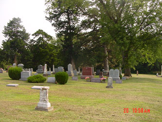
Plymouth Cemetery | ||||||||
|
| ||||||||
| Name of Cemetery | Plymouth Cemetery | |||||||
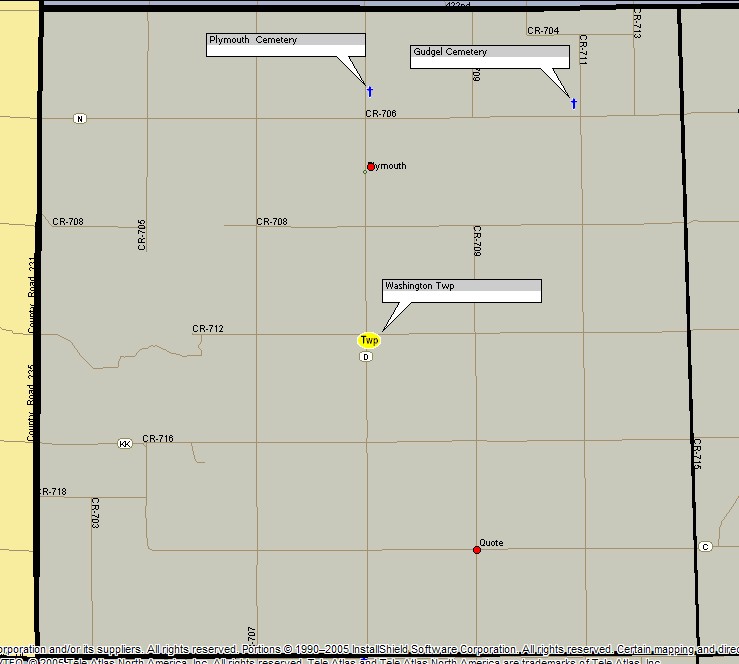
| Township | A1 Washington Twp | |||||||
| Cemetery # | # | |||||||
| Alternate Names | xxx Cemetery | |||||||
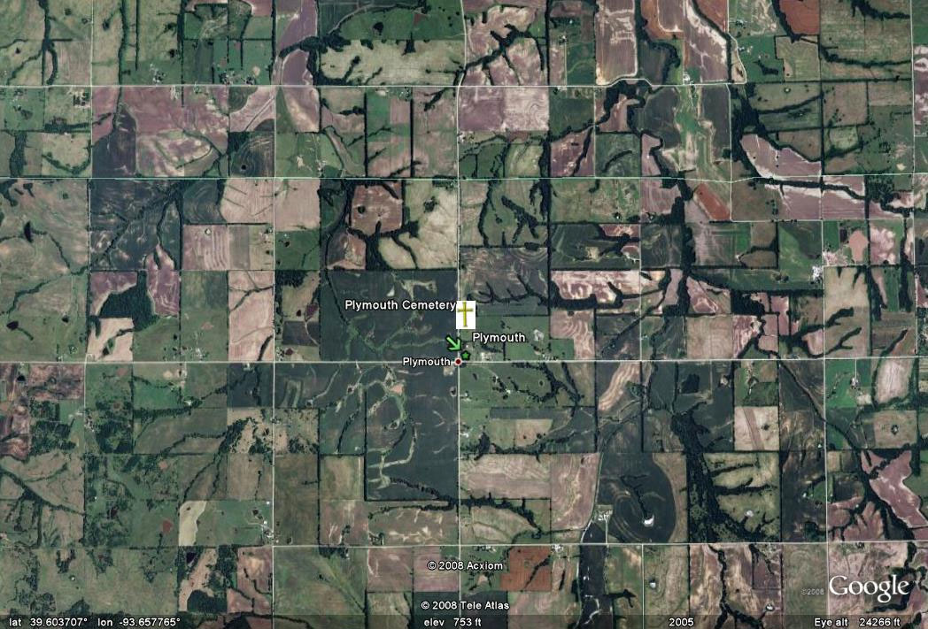
| Latitude/Longitude | Latitude: 39.6006°; Longitude: -93.7014° | |||||||
| Township/Range/Section | T54/R25/S03 | |||||||
| Cemetery Still in Use | Yes | |||||||
| Size of Cemetery | medium | |||||||
| Condition | well maintained | |||||||
| Range of Burial Dates | ||||||||
| Oldest Known Stone: | xxxx | |||||||
| Last Known Burial | xxx | |||||||
| Visited yet? | CC - yes | |||||||
| Location/Directions/Comments | ||||||||
| Most recent directions | 2/10 mile north of the intersection of Hwy D & Hwy N (Plymouth) | |||||||
| original webpage | x | |||||||
| Ancestry.com | xxxx | |||||||
| DAR Index: | xxx | |||||||
| LS info | xxx | |||||||
| Other Comments | xxx | |||||||
| Plat Maps | year | marked? | who's land? | |||||
| T/R/S | Original Land Grants | |||||||
| 1877 | yes/no | |||||||
| 1897 | yes/no | |||||||
| 1914 | yes/no | |||||||
| 1930 | yes/no | |||||||
| 1959 | yes/no | |||||||
| 1970 | yes/no | |||||||
| 1976 | yes/no | |||||||
| 1997 | yes/no | |||||||
| 2005 | yes/no | |||||||
| Transcriptions online: | ||||||||
| Carroll County Archives | ||||||||
| Ancestry.com | ||||||||
| Find-A-Grave | ||||||||
| Other Online Link | ||||||||
| Compilations | xxxx | |||||||
| Library References | ||||||||
| CCGA | Carroll County Cemeteries - volume 1 | |||||||
| Genealogical Library - Ray County Museum | ||||||||
| Ray County Library - Richmond | ||||||||
| Mid-Continent Library | ||||||||
| Family History Library (FHL) | ||||||||
| Lookups | xxxx | |||||||
Carroll County Home Page | MoGenWeb | USGenWeb | WorldGenWeb
To add additional information relating to Carroll County, Missouri Genealogy, E-Mail the county coordinator.
Last Updated