 |  |
| | |
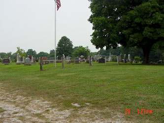
McCroskie Creek Baptist Church Cemetery | ||||||||
|
| ||||||||
| Name of Cemetery | McCroskie Creek Baptist Church Cemetery | |||||||
| Date Established | 1855 | |||||||
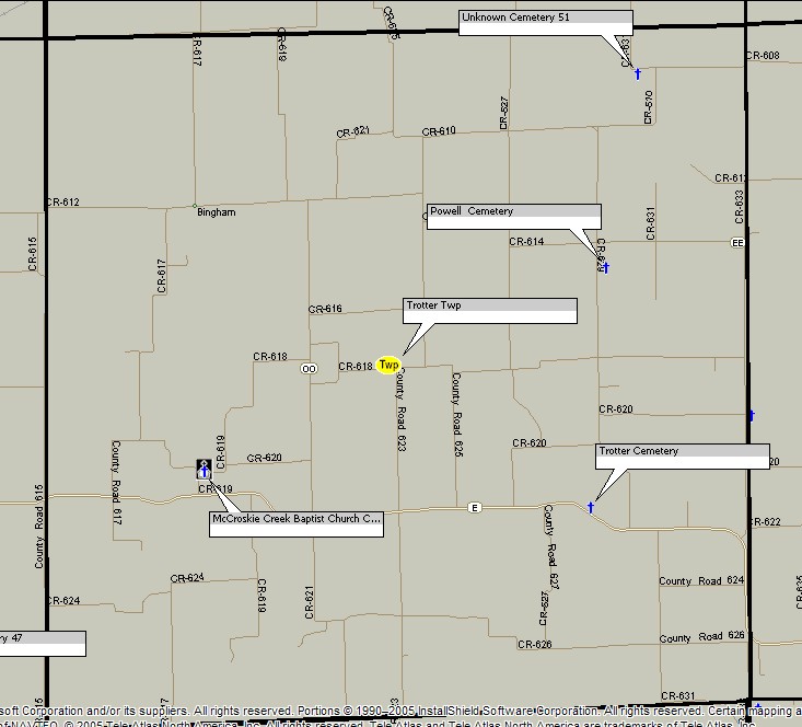
| Township | C2 Trotter Twp | |||||||
| Cemetery # | # | |||||||
| Alternate Names | Beaty Cemetery | |||||||
| Latitude/Longitude | Latitude: 39.3840°; Longitude: -93.619996° | |||||||
| Township/Range/Section | T53R24S20 | |||||||
| Cemetery Still in Use | Yes | |||||||
| Size of Cemetery | medium | |||||||
| Condition | well kept cemetery located next to McCroskie Creek Baptist Church (just east of the cemetery) | |||||||
| Range of Burial Dates | ||||||||
| Oldest Known Stone: | xxxx | |||||||
| Last Known Burial | xxx | |||||||
| Visited yet? | CC - yes | |||||||
| Location/Directions/Comments | ||||||||
| Most recent directions | located 2/10 miles north of State Hwy E on CR-256 | |||||||
| original webpage | ||||||||
| Ancestry.com | xxxx | |||||||
| DAR Index: | xxx | |||||||
| LS info | xxx | |||||||
| Other Comments | Epodunk.com has the cemetery located at: latitude: 39.381N; longitude: -93.643W; this is incorrect | |||||||
| Plat Maps | year | marked? | who's land? | |||||
| T/R/S | Original Land Grants | |||||||
| 1877 | yes/no | |||||||
| 1897 | yes/no | |||||||
| 1914 | yes/no | |||||||
| 1930 | yes/no | |||||||
| 1959 | yes/no | |||||||
| 1970 | yes/no | |||||||
| 1976 | yes/no | |||||||
| 1997 | yes/no | |||||||
| 2005 | yes/no | |||||||
| Transcriptions online: | ||||||||
| Carroll County Archives | ||||||||
| Ancestry.com | ||||||||
| Find-A-Grave (McCroskie Creek Baptist Church Cemetery) others should be merged with this one Find-A-Grave (Beaty) Find-A-Grave (McCroskie) | ||||||||
| Other Online Link | ||||||||
| Compilations | xxxx | |||||||
| Library References | ||||||||
| CCGA | Carroll County Cemteries - volume 3 | |||||||
| Genealogical Library - Ray County Museum | ||||||||
| Ray County Library - Richmond | ||||||||
| Mid-Continent Library | ||||||||
| Family History Library (FHL) | ||||||||
| Lookups | xxxx | |||||||
Carroll County Home Page | MoGenWeb | USGenWeb | WorldGenWeb
To add additional information relating to Carroll County, Missouri Genealogy, E-Mail the county coordinator.
Last Updated