 |  |
| | |
| Comer Cemetery | ||||||||
| Name of Cemetery | Comer Cemetery | |||||||
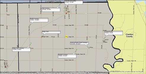
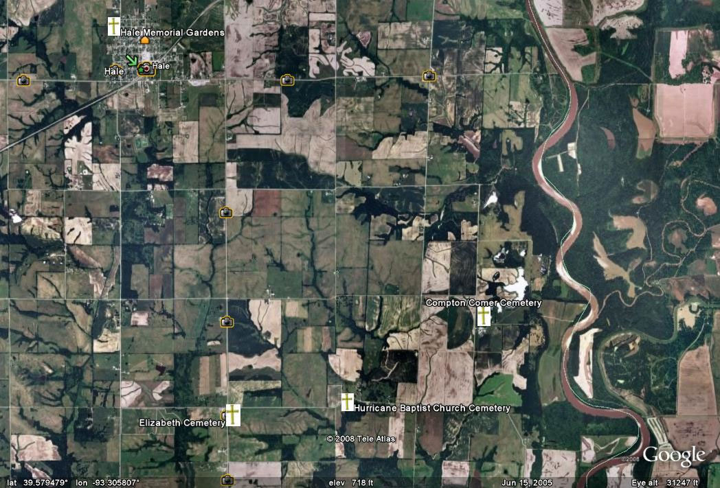
| Township | A4 Hurricane Twp | |||||||
| Cemetery # | # | |||||||
| Alternate Names | Compton Cemetery | |||||||
| Latitude/Longitude | Latitude: 39.5699; Longitude: -93.2847 | |||||||
| Township/Range/Section | T55R21S20 | |||||||
| Cemetery Still in Use | Yes/No | |||||||
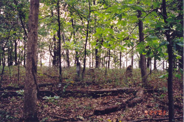
| Size of Cemetery | small | |||||||
| Condition | poor condition | |||||||
| Range of Burial Dates | ||||||||
| Oldest Known Stone: | xxxx | |||||||
| Last Known Burial | xxx | |||||||
| Visited yet? | CC - yes/no................ JZ - yes/no...........anyone else - yes/no | |||||||
| Location/Directions/Comments | ||||||||
| Most recent directions | on Private Property, located on Don Lyons farm From Hale take hwy 139 south, turn east (left) on county road HH follow to end turn south (right) to first farm on east (left) | |||||||
| original webpage | ||||||||
| Ancestry.com | xxxx | |||||||
| DAR Index: | xxx | |||||||
| LS info | xxx | |||||||
| Other Comments | xxx | |||||||
| Plat Maps | year | marked? | who's land? | |||||
| T/R/S | Original Land Grants | |||||||
| 1877 | yes/no | |||||||
| 1897 | yes/no | |||||||
| 1914 | yes/no | |||||||
| 1930 | yes/no | |||||||
| 1959 | yes/no | |||||||
| 1970 | yes/no | |||||||
| 1976 | yes/no | |||||||
| 1997 | yes/no | |||||||
| 2005 | yes/no | |||||||
| Transcriptions online: | ||||||||
| Burial Records Submitted by Researchers | ||||||||
| Ancestry.com | ||||||||
| Find-A-Grave | ||||||||
| Other Online Link | ||||||||
| Compilations | xxxx | |||||||
| Library References | ||||||||
| CCGA | Cemeteries of Carrol County - volume 2 | |||||||
| Genealogical Library - Ray County Museum | ||||||||
| Ray County Library - Richmond | ||||||||
| Mid-Continent Library | ||||||||
| Family History Library (FHL) | ||||||||
| Lookups | xxxx | |||||||
Carroll County Home Page | MoGenWeb | USGenWeb | WorldGenWeb
To add additional information relating to Carroll County, Missouri Genealogy, E-Mail the county coordinator.
Last Updated